
UPDATE 5:45 A.M. MONDAY
By Jake Bowles
More than a dozen tornadoes were reported across several Kansas counties Sunday night.
National Weather Service crews will be out surveying damage and verifying which reported tornadoes or funnel clouds touched down. Trained spotters and storm chasers reported tornadoes in Sumner, Reno, Barton, and Rice Counties. A tornado warning was issued for Sedgwick County at around 9 p.m., but no touchdown has been confirmed.
Barton County Dispatch reported trees and power lines down, as well as damage to a home, a silo and a feed lot. That damage is believed to have been caused by a tornado. Another tornado is believed to be responsible for a destroyed shed two miles northwest of Wellington in Sumner County.
Hail up to the size of baseballs fell in Barton County near Ellinwood, and tennis ball-sized hail smashed at least one windshield near Claflin. Hail in Sedgwick County measured up to golf ball size, and quarter- to dime-size hail blanketed the ground in west Wichita.
Flooding was reported in Reno, Rice and Sedgwick Counties. Almost an inch and a half of rain fell Sunday night at Eisenhower National Airport, with reports of more than two inches of rain three miles north of the airport. A National Weather Service employee reported one to two feet of water over parts of Maize just north of Maple.
Sedgwick and surrounding counties are now under a Flash Flood Watch until Wednesday evening. Multiple rounds of thunderstorms through mid-week will lead to an increased risk of flash flooding and river flooding across central, south central and southeast Kansas. Widespread rainfall amounts of 2 to 4 inches is expected, with higher amounts likely where repeated thunderstorms hit the same area.
ORIGINAL STORY
By Heather Larson
Severe weather affected several counties in South Central Kansas Sunday night.
Spotters reported funnel clouds in Hutchinson, South Hutchinson, and Nickerson. No reports of major damage came in, but there were reports of hail damaging cars.
Severe weather highlights:
- A trained spotter reported a funnel cloud in Reno Co. 1 mile NNE of Partridge.
- A tornado spotted by a storm chaser 2 miles SSW of South Hutchinson in Reno Co.
- Penny-sized hail covering the ground at the NWS office in West Wichita.
- 1″ hail covered the ground near 119th and Central
- A storm chaser took a photo of a tornado 3 miles SW of Alden in Rice Co.
- A spotter reported winds of 90-100 mph 6 miles N or Nickerson in Rice Co.
- Tornado spotted by first responder 5 miles SW of Nickerson in Reno Co.
- Funnel cloud spotted by a trained spotter 6 miles ENE of Danville in Sumner Co.
Reports of hail came in from across the KFDI listening area. Sizes were from pea-size all over to golf ball size hail in Mulvane, the latter reported by a listener at 130th/Oliver.
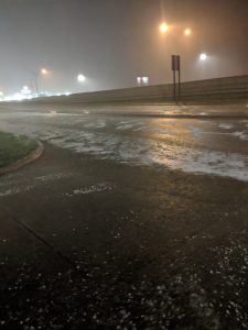
Photo taken by KFDI storm chaser Lance Ferguson from KFDI Mobile 27.