
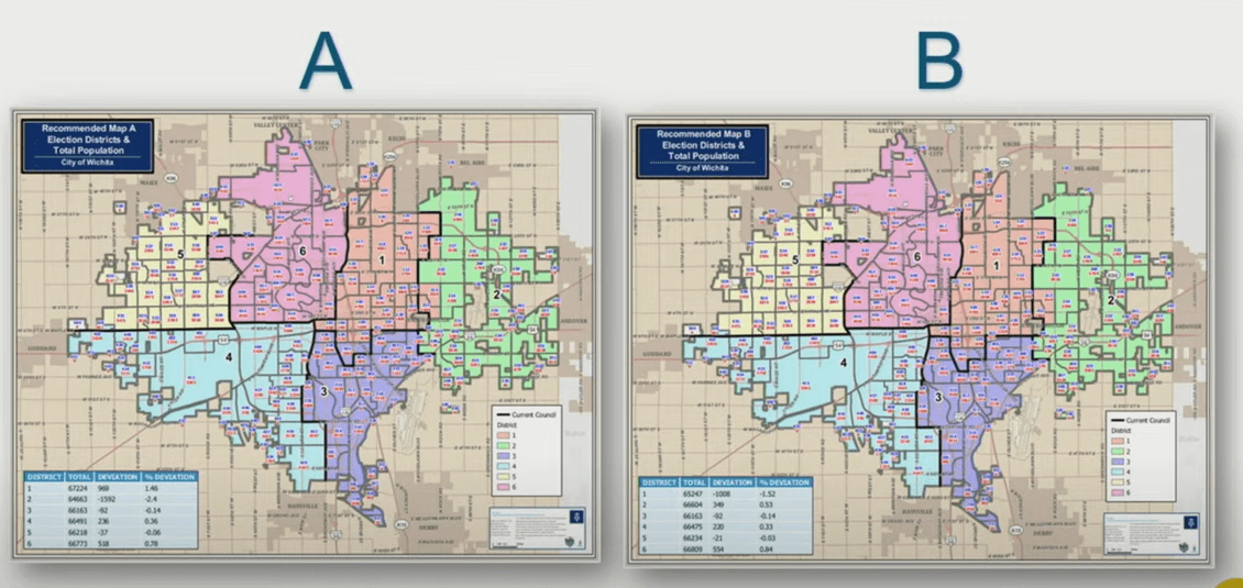
Wichita City Council members were presented Tuesday with two possible maps for the six council districts.
The districts have to be redrawn every ten years after the U.S. Census is complete. City planner Scott Wadle told the council that the districts can have no more than five percent deviation in their population numbers. He said with the current districts, District 2 is slightly above five percent and District 3 is slightly below.
The City Council appointed a commission of electors earlier this year to get public input and redraw the boundaries. Wadle said the commission had eight meetings and looked at 20 different concepts. He presented two maps, Map A and Map B, for consideration by the Council. Wadle said the maps were presented to the six District Advisory Boards, and three of them supported Map A while the other three favored Map B. Vice Mayor Becky Tuttle said her DAB felt that both maps were good and there was not a huge disagreement over them.
Wadle said election precincts had to be followed to redraw the council districts, and the maps will move several precincts from one district into another. He said there was a challenge in keeping Neighborhood Associations and Homeowners Associations together in southeast Wichita, because the precinct boundaries did not match up with those groups. Council member Jeff Blubaugh said he has received feedback with concerns over splitting the neighborhood and homeowner associations.
The Council will have more discussions on the two maps in the coming months, and they have until the end of the year to decide on the new boundaries. They did not set a specific timeline for a decision.


